Historical version 6 of Locale Crystal Palace (view current version)
An area of South-East London.
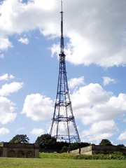
Historically, this isn't an area name, but merely the site of the eponymous glass building, re-erected in an open area of Upper Sydenham overlooking London, which came to be called Crystal Palace Park. However, the name Crystal Palace has come to be associated with the area, which is at the borders of [Upper Norwood]?, Upper Sydenham and Anerley, mostly in SE19. It is at the borders of the London Boroughs of Croydon (to the south-west), Lambeth (north-west), Bromley (south) and Southwark (north-east).
Most of the commercial and social activities take place in a triangle of one-way roads, with Westow Hill along the north side, Westow Street on the west, and Church Road rejoining Westow Hill at the north-western corner of [Crystal Palace Park]?.
See also:
Auto-generated list of things in Crystal Palace (view them on a map):
- Bec
- Bookseller Crow On The Hill, SE19 3AF
- Brown And Green On The Triangle, SE19 2PR
- Brown And Green, SE19 2AZ
- Crystal Palace Market, SE19 2TF
- Crystal Palace Station
- Everyman Crystal Palace
- Four Hundred Rabbits, SE19 3AH
- Gipsy Hill Station
- Railway Bell, SE19 1PF
- Royal Albert, SE19 1RX
- Westow House, SE19 1TX